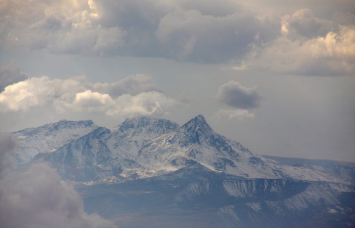
City of Artashat: Location
Artashat was built by Artashes I, the founder of Artashesyan dynasty, in 189-188 BC. The city was founded in Ararat Plain, in front of biblical Mount Ararat.
City of Artashat: Brief History
Artashat was built by one of the greatest Armenian Kings Artashes I (189-160 BC). Excavations showed that in the territory where the city was built there used to be a large Urartian city, which remains unknown until the present day. There is some vagueness, however, regarding who built the city. Some historians among them Plutarch and Strabo claimed the place for the city was chosen and designed by Punic Carthaginian Military Commander Hannibal who resided in the court of Artashes I after Antiochus the Great lost the Battle of Magnesia in 190 BC. Hannibal was appointed adviser to the Armenian King. In contrast, according to Armenian historian Movses Khorenatsi (Moses of Khorene), the city was built by Artashes I and only.
During the rule of Artavazd II, Hellenistic culture had reached its peak. Especially the theater was developing. King Artavazd was considered an expert in arts. He used to compose tragedies.
Artashat was the main capital city of Greater Armenia for 600 years.
Artashat was captured in 58, and a year later destroyed and burned by Roman commander Gnaeus Domitius Corbulo. In 63 Armenia-Parthian troops defeated Romans and Roman Emperor Nero agreed that Tiridates, the brother of the Parthian King, occupied the Armenian throne if the latter received the crown from Rome.
Tiridates I (63-88) established the dynasty of Arshakunis. Tiridates returned from Rome in 66 and rebuilt Artashat. Years later (114) Roman Emperor Trajan invaded Armenia and captured Artashat. In 163 Artashat was again ruined; it was after Armenians rebelled against Rome but lost.
The City of Artashat remained Armenia’s primary cultural, political and economic center until the 4th century; that is before Shapur II destroyed the city and captured the population.
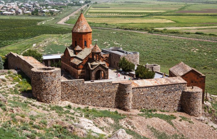
City of Artashat: Citadel
For around 600 years Artashat has managed to preserve the title of one of the most popular cities of the East. To the north-west of Khor Virap Monastery, on top of the largest hill coming at the height of 70 meters there is the citadel of Ancient Artashat. It included the palace, military garrison and arsenal and the administrative buildings. The preserved pieces of the palace occupy a territory of 2750 square meters. It’s where Carthaginian Military Commander Hannibal used to reside when he was in Artashat.
City of Artashat: Defense
Artashat was built in the confluence of rivers Araks and Metsamor. The rivers formed a deep channel, which served as a natural defense for the city.
According to Strabo and Cornelius Tacitus, the walls of the city were more than 10,000 meters high. Only 5000 meters were uncovered and studied. The city was built on 12 big and small hills, and each of these hills ensured the defense of the city. The second wall of the citadel is Urartian. It was rebuilt in accordance with the demands of the Hellenistic military art.
City of Artashat: Drinking Water Supply, Baths
Drinking water was supplied through wide clay pipes. The amount of water Artashat received was enough for a city with a population of 100,000. The water was distributed to the upper districts of the city through narrow clay pipes.
In various parts of the city drainage channels were discovered. Other than that, Armenians were familiar with the baths, which had already become widespread among Greeks and Romans. Already in the 2nd-3rd centuries both private and public baths were built in the city. One public bath and two private baths were uncovered. One of the private baths can be found to the south-east of the Temple of Apollo. Only seven rooms were uncovered. “Hypocaust” system was used to heat the bath. It worked in the following way – the smoke of the furnace passed under the floor and heated the walls and the floor of the bath by coming out through the wall pipelines. (The use of hypocaust heating system originated in ancient Rome and was widely used in medieval Armenian castles and wealthy houses.)
City of Artashat: Hills
The first hill is the farthest. This hill is thoroughly excavated. It bore military-defensive significance and protected the citadel’s northern gate. Over 3000 arrow-head spears, swords, pottery were discovered.
The fifth hill was convenient for living there. Traces of large stoves were found there. The remainders of several buildings allow to conclude that there used to be a custom house and one of the city’s square markets. The seventh and eighth hills are where the middle rank people used to reside.
City of Artashat: Coins and Seals
Artashat was one of the best known trade centers of the ancient world. As Tabula Peutingeriana map of 1265 shows the city was connected to a number of trade cities in the world among them the Eastern-Mediterranean cities.
Artashat was an important trade center and it is seen by the silver and gold coins belonging to other countries and cities. Interestingly, the coins of Artashat had an inscription on them. It read “Artashat, the Capital.”
Of utmost value are the seals found particularly from the fifth and eighth hills. Over 8000 clay seals were discovered, and they date to 180 BC to 59. Around thirty of those seals come with Aramaic and Greek inscriptions.
City of Artashat: Temple of Apollo
During the construction of the City of Artashat (189-188 BC) the Temple of Apollo, one of the most significant buildings of the city was built. It was dedicated to the God of Sun.
The temple that dated to the Hellenistic Era was destroyed in 59 by Domitius Corbulo. During the reign of Tiridates I a new platform and temple were built. Both the platforms and the temple were made of limestone. Also, the temple included bas-reliefs.
To the east of the second platform six of the entrance stairs leading to the sacred platform were uncovered. The exact place of the platform was for a rather long time unknown and disputable.
After Christianity was adopted state religion, the temple was ruined. Ultimately, the City of Artashat is one of the best sites visitors should visit. It was one of the most developed cities of Greater Armenia and what’s left from the glorious past is of utmost importance to Armenian people and those who are interested in history and its course of development.
Summing up there is one thing to add to have an even clearer idea how prosperous Artashat was – Armenian King Tigran II populated the city with the people that had been captured from 12 hellenistic cities of the world. During its flourishing period (1-2 centuries BC) it had a population of 150,000. The city was enlarged and covered a territory of 400 hectares. Not in vain it remained the Armenia’s capital city for around six centuries symbolizing its independence and strength.