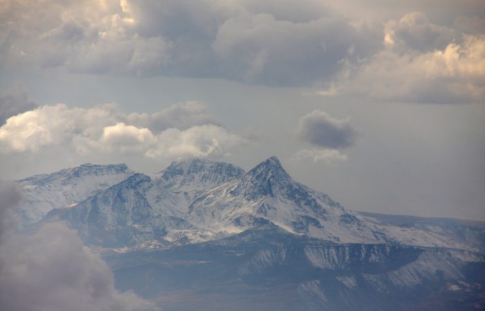
Smbataberd Fortress: Location
Smbataberd Fortress, which is one of the most interesting and memorable travel destinations, is located on the western side of Yeghegis Village on top of vertically rising inaccessible mountains. The road to the fortress is very narrow. Several cars like Lada Niva might be an option, but reaching the fortress on foot is much more entertaining. Also, the on-foot option is the best if it has recently rained there.
Smbataberd Fortress: Naming
The name of this fortress is not clear yet. Traditionally, it’s called Smbataberd. It presumably has to do with King Smbat who is buried in the nearby village of Yeghegis and who is believed to have reconstructed the fortress.
Another more reliable assumption is the fortress got its name from Prince Smbat of Syunik who lived in the tenth century. In his work “History of Sisakan” (Syunik ) Armenian historian Stepanos Orbelyan wrote: “When in 922 upon the order of Yusuf amira of Atrpatakan, general Nsr attacked Syunik, ruling Prince Smbat organized resistance in Yeghegis. Seeing they are unable to bring down the defenders the enemy retreated. Meanwhile, wise Smbat was quietly sitting in Vayots Dzor Province.”
Smbataberd Fortress: General
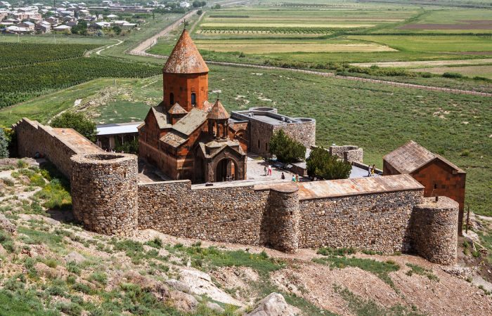
The fortress is protected from the east, west and south by natural cliffs, which are strengthened by tall and wide pyramid walls. The fortress is accessible only from the northern side. The structure of the fortress walls lets us conclude the fortress dates back to the 10th-11th centuries. The walls are 2-3 meters wide. It is much likely the fortress was built by Smbat II Tiezerakal (Master of the Universe) Bagratuni when the construction of defensive systems started flourishing. It is also not excluded that Smbataberd is the same fortress mentioned as Symbace in Greek geographer and historian Strabo’s work “Atropatene.”
The fortress was included into Atropatene when Armenia was under the Roman rule. In Greco-Roman sources Atropatene refers to the “State of Atrpatakan.”
Smbataberd is one of the oldest and largest fortresses in Syunik Province. Quite possibly it came into existence before the 5th century. The fortress was fortified under the control of Armenian noble family of Orbelyans.
Smbataberd Fortress: Complex
The location of the fortress made it inaccessible for the enemies. The fortress was protected by the deep canyons of rivers Artabun and Yeghegis. Later the 2-3 meters wide walls of the fortress were built. Presently, only the northern part is preserved. The walls were fortified by pyramid-like towers.
The territory of the fortress was enough to accommodate hundreds of people. At its upper part the fortress had two citadels meant for the princes and their kinsmen. A wall divides the fortress into northern and southern parts in which the ruins of citadels, living area were discovered.
Water was supplied to the fortress through underground water pipe from the springs found close to Tsakhats Qar Monastery. The most vulnerable part of every military-defensive structure is its entry.
The main entry to the fortress is from the north. Two more entries can be found to the west and east of the fortress. The main entrance of the fortress was made upon the principle of barbican (a fortified outpost or gateway), which means that the high walls and the steep rocks didn’t allow to advance into the fortress and it gave an opportunity to keep the situation under control.
The citadel of this fortress is where the economic structures, arsenals, living areas and so on, once were. Whenever the living areas of the fortress were captured, the population found shelter in the citadel where prior to that food, water and ammunition were stored.
The Bronze Age and Urartian settlements of Armenia had more than one citadel with which the upper parts of the city were fortified. Other than that, citadels were used to suppress the inner revolts, although similar cases have not been recorded in case of Smbataberd Fortress.
The citadels of Smbataberd Fortress used to occupy the upper parts. They covered the entire mountain top, but archaeological excavations were held only on one part of the walls.
Lastly, consider that on the top there is no water and if there is, then it’s somewhere unnoticeable. So don’t take the risk and simply have water bottles with you so that all your attention is not focused on your thirst instead of the beautiful, yet ruined fortress.


, Armenia")

